
Babino Polje, Monténégro – Lac Hrid Plav, Monténégro
Difficulté : modérée
Babino Polje, Monténégro – Lac Hrid – Plav, Monténégro
This hiking section begins from Babino Polje, following the 4WD track northeast. After 5 minutes, take a right at the signpost to Hrid Lake. Continue south along the dirt road for 3.6 km tthrough the seasonal settlement of Bajrovica Katun where the hiking trail splits from the vehicle track to single hiking trail. In Bajrovic Katun settlement there is a cozy guesthouse and Coffee Bar where you can stop for a relaxing and refreshing brake.
The next 3.2 km leads you through a serene high pine forest to the stunning Hrid Lake, filled with crystal-clear glacial water. The lakeshore is perfect for picnics, meditation, or a refreshing swim. Bring insect repellent, as mosquitoes are common near the water.
From Hrid Lake, the trail climbs 450 m west across a rocky section before merging back onto a 4WD track. Follow the track northwest for 1.5 km to a small timber shelter, then divert west onto a hiking path through birch, beech, and pine forests for 3.3 km. This path ends at the tiny seasonal settlement of Treskavica, where fresh local sheep dairy products are available. This section passes through the most protected area of the Accursed Mountains in Montenegro.
The trail then descends moderately southwest along a 4WD track for 2.2 km, followed by a short 600 m hiking path until the small barn cabin. From here, hikers can arrange a car transfer directly to Plav or continue hiking through the final 4WD section following the traditional shepherd villages in outskirts of Plav town.
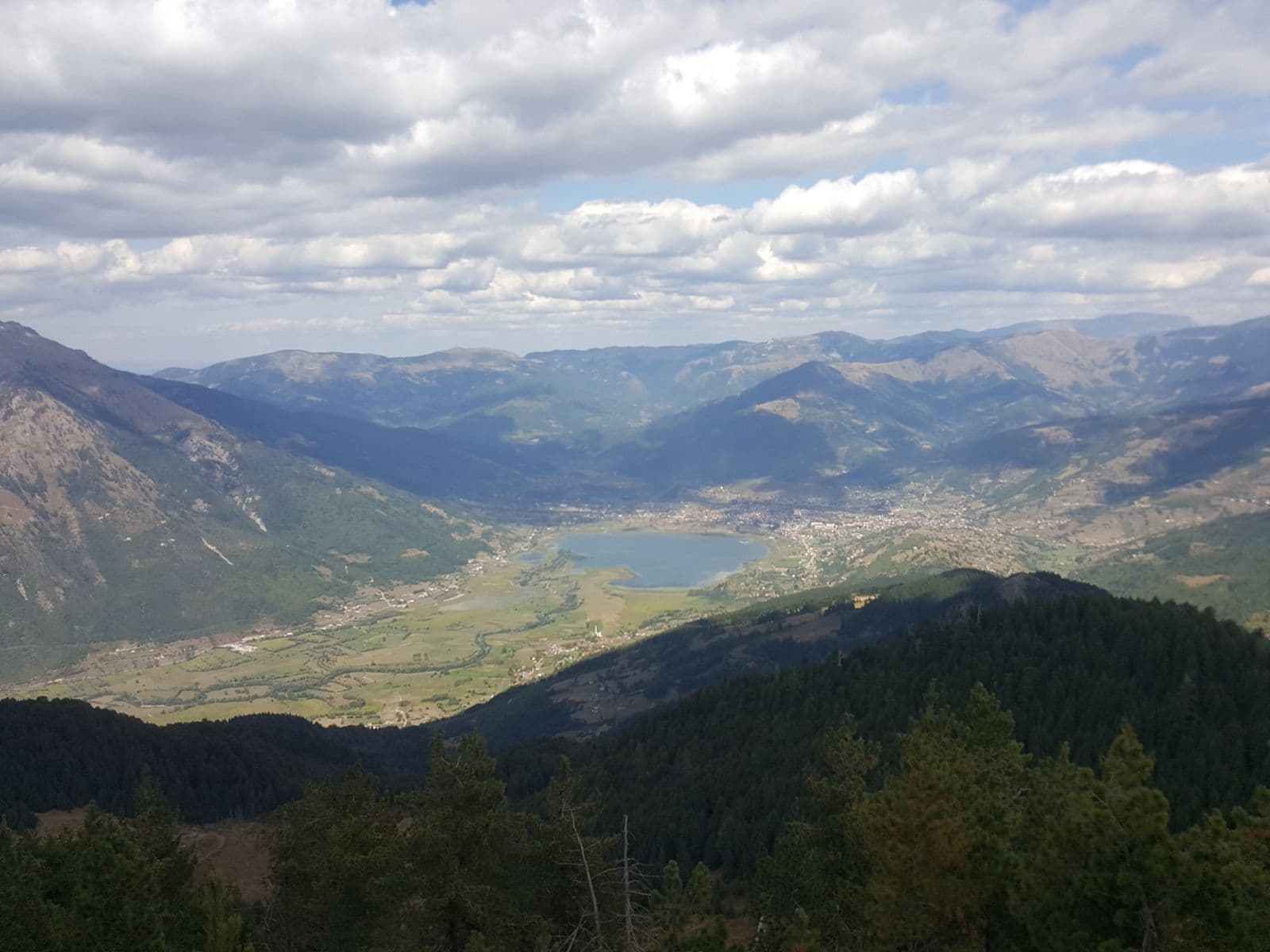
Plav is a charming Montenegrin town on the northeast shore of Plav Lake, offering restaurants, coffee bars, and an ATM for convenience.
Carte des sentiers
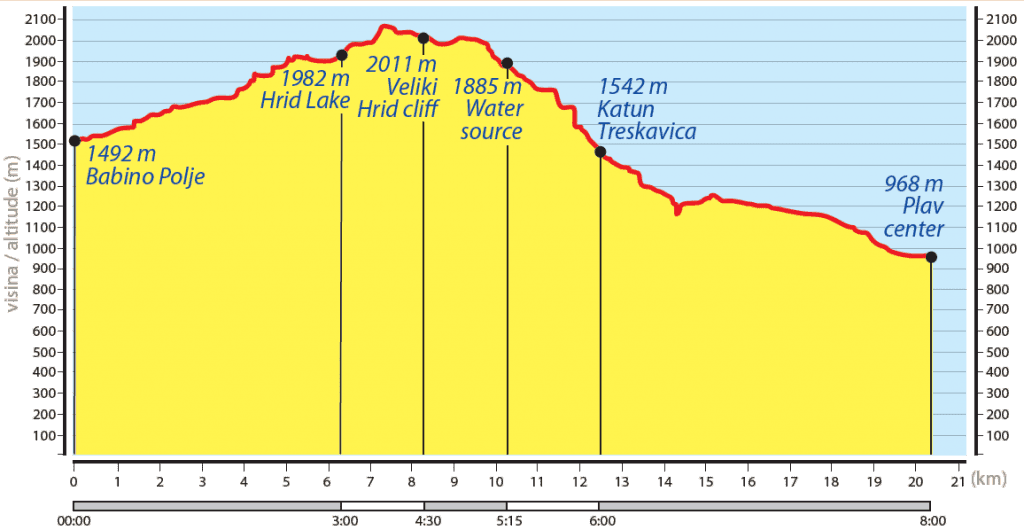
Profil d'élévation
Télécharger le tracé GPX
Importez cette trace dans votre appareil GPS ou votre application de randonnée