
Plav, Montenegro –Bor Peak – Vusanje, Montenegro
Difficulty: moderate
Plav, Montenegro –Bor Peak – Vusanje, Montenegro
Plav to Vusanje Hike: Peaks of the Balkans Trail Guide (Stage Overview)
The Plav to Vusanje stage is one of the longest and most diverse sections of the Peaks of the Balkans trail, offering hikers a rewarding mix of forest paths, high alpine plateaus, and sweeping cross-border views across Montenegro and Albania.
The stage departs directly from Plav, a small Montenegrin town with grocery stores and ATMs — making it a convenient last stop to stock up before heading into the mountains. From here, the route follows a 4WD track west for 9 km, with an optional car transfer available to skip this opening stretch and jump straight into the trail.
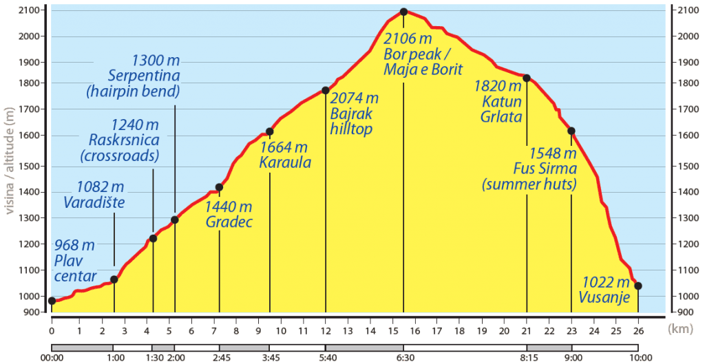
Once the track gives way to footpath, the real adventure begins. A 2.9 km ascent winds through fragrant pine and beech forests, climbing steadily to Bori’s Peak (2,074 m) — the highest point of this stage. The final push to the summit is steep with loose terrain, but the effort pays off with panoramic views of Plav Lake, the imposing Kollata Peak (2,535 m), and the dramatic ridgeline of the Karanfili Range.
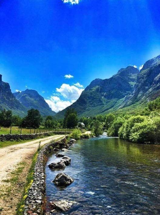
From the summit, the trail sweeps southwest across an expansive high alpine plateau for 1.8 km, where unobstructed 360° views take in the full breadth of the Montenegrin and Albanian mountain ranges. The descent then turns northwest, dropping down toward Vusanje (Vuthaj) at 1,000 m through seasonal shepherd settlements, mountain streams, and traditional stone houses — a landscape that feels untouched by modern tourism.
A 4WD track guides hikers directly into Vusanje village, the gateway to the stunning Ropojane Valley. Home to a welcoming Albanian community, Vusanje is a growing favourite among regional hikers and nature lovers. The village boasts natural highlights including the Gerla Waterfall and the vivid turquoise Blue Eye glacial spring — both well worth exploring before or after the trail. Several guesthouses and restaurants make Vusanje an ideal overnight base before continuing deeper into the Peaks of the Balkans.
.
Trail Map
Elevation Profile
Download GPX Track
Import this track into your GPS device or hiking app