
Theth, Albania – Valbone, Albania
Difficulty: moderate
Theth to Valbona via Valbona Pass: Classic Albanian Alps Hike – Complete Trail Guide
Theth Valbone trail stage of Peaks of the Balkans via Valbona Pass (1,795 m) is one of the most iconic and beloved day hikes in the Albanian Alps, tracing a historic mule track that once connected the ancient tribal regions of Shala and Nikaj. Descending from the pass into the breathtaking Valbona Valley, this classic route is a must-do for any hiker exploring the Accursed Mountains.
The trail begins in the heart of Theth (745 m), heading northwest along a gravel road beside the Theth River — with the main bridge of Theth serving as a convenient orientation point. Shortly after crossing a small footbridge over a stream, the route reaches a junction and continues right toward the northwest. Within a few hundred meters, clear signposts direct hikers toward either Gusinje (Montenegro) or Valbona Valley — follow the Valbona direction as the trail ascends gently along a dirt road toward the first houses of the Gjelaj settlement.
At the edge of Gjelaj, the route turns sharply left onto a tractor track before narrowing into a forest path and entering one of the trail’s most enchanting sections — a 1.2 km stretch through old-growth beech and birch forest that opens onto a picturesque alpine meadow, ideal for a scenic rest. From mid-May to late October, the nearby Zef Rrgalla coffee hut offers hot and cold drinks and light snacks — a welcome stop before the final climb.
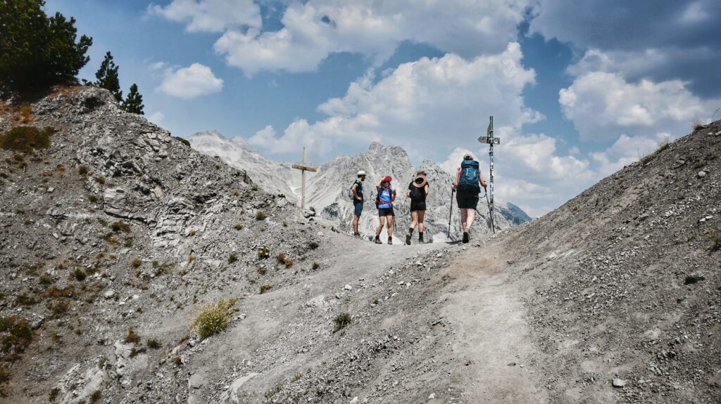
Valbona pass Qafa Valbones
From the meadow, the trail climbs steadily northeast for approximately 1.5 km to Valbona Pass — the undisputed highlight of the entire route. At the summit, one of the most iconic panoramic vistas in the Albanian Alps unfolds in both directions: the traditional stone village of Theth stretching to the west, and the dramatic glacial landscape of Valbona Valley opening to the east. It is one of the most photographed viewpoints in all of the Western Balkans.
The descent into Valbona begins with a series of switchback zigzags heading north then northeast. After the gravel switchbacks, the trail crosses a dry streambed and arrives at Simoni Café, positioned beside a fresh mountain spring — a perfect spot to refill water bottles or enjoy a final refreshment before the steeper descent ahead. From here the trail bears left, dropping steeply toward Rragam on the outskirts of Valbona Valley, before following a 4WD track east along the riverbed to the end of the asphalt road near Fusha e Gjesë.
For those seeking a shorter ascent, a vehicle transfer from Theth to Gjelaj can be arranged, cutting directly to the start of the main hiking trail and saving time and elevation on the lower road section.
Video description of the trail
Trail Map
Elevation Profile
Download GPX Track
Import this track into your GPS device or hiking app