
Cerem, Albania – Doberdol, Albania
Difficulty: moderate
The Çerem to Dobërdol stage is one of the most scenically rewarding cross-border sections of the Peaks of the Balkans trail, weaving through remote Albanian and Montenegrin highland landscapes before arriving at one of the route’s most iconic high-altitude destinations.
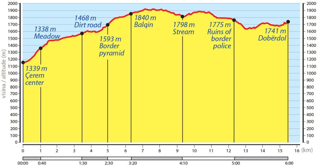
The stage opens with an optional 3.3 km stretch along a 4WD dirt track heading northeast — a popular choice among hikers for its convenient access to accommodation. Along the way, a small seasonal coffee hut offers a welcome early rest stop with sweeping panoramic views over the Çerem Valley, the dramatic Kollata massif, and Bori’s Pass. A nearby natural spring provides a reliable source of drinkable water before the climb begins.
From the junction, the track narrows to a true mountain path and climbs toward the Albania–Montenegro border crossing, marked by a traditional stone boundary marker. The trail briefly enters Montenegro, winding through beautiful old-growth forest before looping back into Albania — a unique cross-border experience that captures the spirit of the Peaks of the Balkans perfectly. En route, the path passes remote seasonal shepherd settlements, including the picturesque Balqinë, perched above the UNESCO-listed Lumi i Gashit Valley — one of the most pristine and ecologically significant river valleys in the entire Western Balkans.
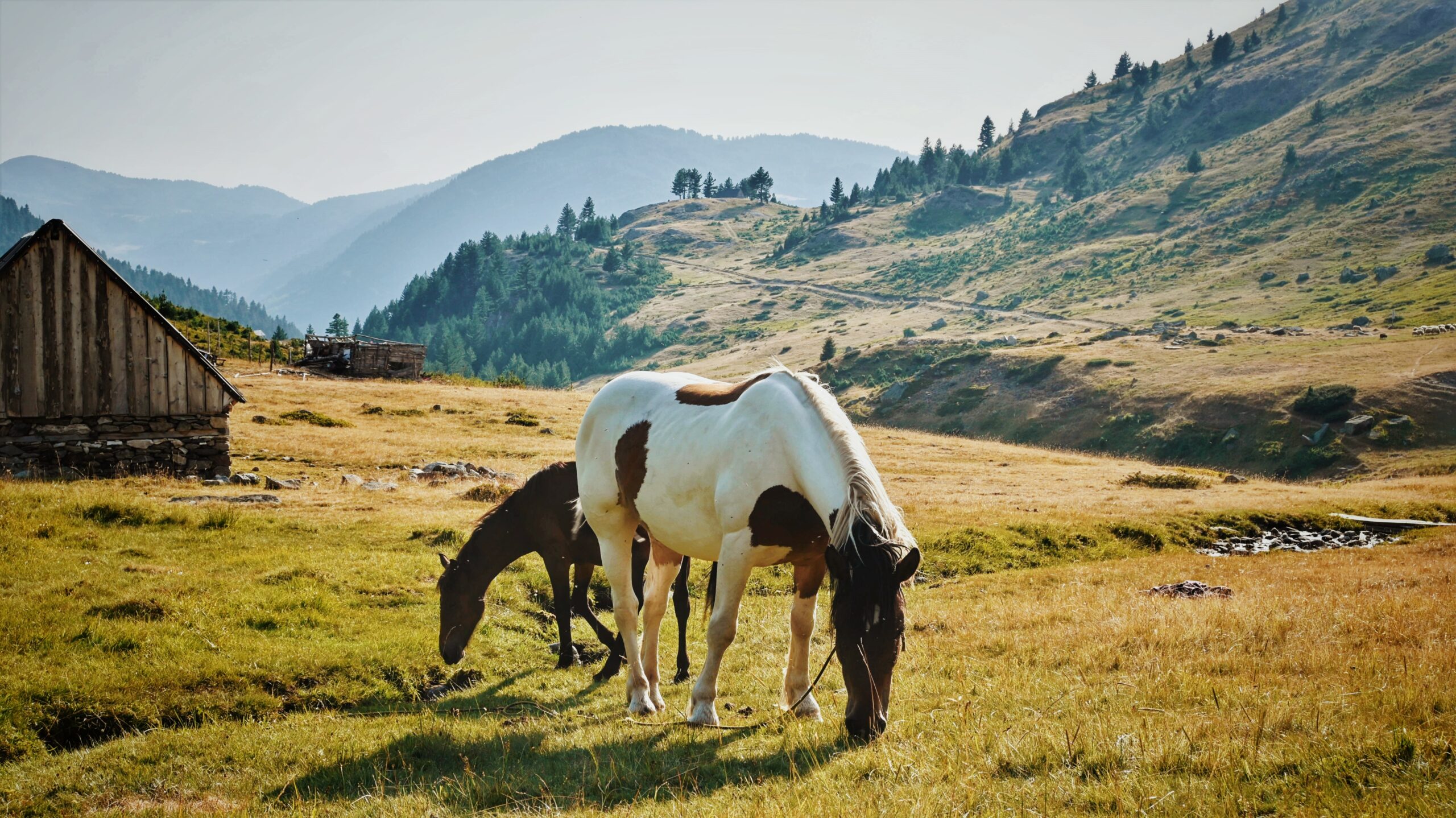
Throughout the summer months, local shepherds along this section often offer simple refreshments and fresh dairy products to passing hikers, while wild berries grow abundantly along the trail — small but memorable highlights that set this stage apart from more conventional hiking routes.
The final section follows high panoramic ridge paths with unobstructed views across the valley below, before a short final ascent reveals the sweeping alpine plateau of Dobërdol (1,800 m). Positioned near the tri-border point of Albania, Kosovo, and Montenegro, Dobërdol is one of the most atmospheric overnight stops on the entire trail. Its rustic wooden huts, welcoming guesthouses, and abundant fresh local dairy products deliver an authentic and deeply memorable high-mountain experience that few destinations in the Albanian Alps can match.
For those not hiking the full trail, Dobërdol is also accessible by 4WD vehicle via rough mountain roads — though travellers should allow 3 to 4 hours from either Çerem or Bajram Curri town, making advance planning essential.
Trail Map
Elevation Profile
Download GPX Track
Import this track into your GPS device or hiking app