
Doberdol, Albania – Milisevc, Kosovo
Difficulty: moderate
Crossing the border from Albania to Kosovo
The Dobërdol to Milishevc stage is one of the most exhilarating cross-border sections of the Peaks of the Balkans trail, tracing high-altitude ridgelines with sweeping views across Albania, Kosovo, and Montenegro — three countries visible from a single mountain summit.
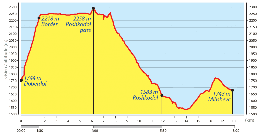
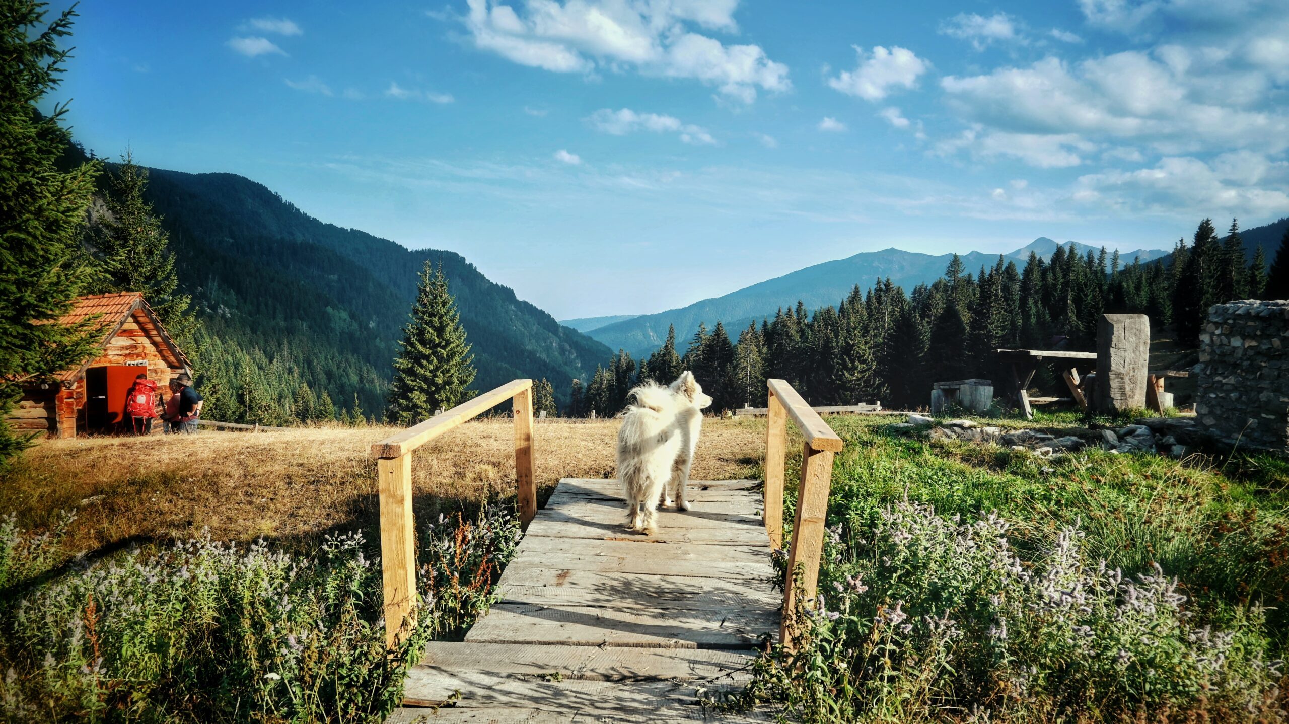
The stage departs from Dobërdol, a remote alpine settlement in Albania that embodies the wild, unspoiled character of the Peaks of the Balkans. Approximately one hour into the hike, the trail reaches a dramatic narrow pass at 2,170 m near the legendary Three-Border Peak (Tromedja) — the undisputed highlight of this stage. An optional short ascent to the summit rewards hikers with some of the most spectacular tri-border panoramic views anywhere in the Western Balkans, making it a must-stop for photography and a genuine bucket-list moment for Balkans hikers.
Descending from Tromedja, the route joins the Via Dinarica trail and continues across a series of scenic high-altitude passes — Bogice, Belegu, and Roshkodol — each offering its own distinctive mountain vistas. The trail then gradually drops into the breathtaking Roshkodol Valley, a hidden gem renowned for its sweeping alpine meadows, crystal-clear mountain streams, and exceptional highland flora. Few valleys on the entire Peaks of the Balkans route match Roshkodol for sheer natural beauty and tranquility.
After passing through the seasonal shepherd settlement of Roshkodol, the route follows a dirt track for approximately 4.6 km through pine forest and rugged mountain terrain to the village of Milishevc in Kosovo. Surrounded by dramatic peaks and dense forest, Milishevc offers cozy guesthouses serving traditional Kosovar cuisine and warm mountain hospitality — a well-earned and deeply satisfying end to one of the finest high-alpine stages on the trail.
Peaks of the Balkans Trail booking
Trail Map
Elevation Profile
Download GPX Track
Import this track into your GPS device or hiking app