
Doberdol – Gjeravice – Gacaferi Pastures
Difficulty: moderate
Doberdol – Gjeravica Peak – Gacafer
Doberdol Gacaferi stage trail you will be climbing the highest mountain top of Kosova Gjeravica Peak (2656m) and the second highest of the Accursed mountains after Jezerca Peak (2694m). The route to the summit from Doberdol, for a part of it, is back and forth and goes to Kosovo side, cross the border which is not heavily guarded anymore as it was in the past. However, during the communist regimes in this part of the world this was the border between Albania and Yugoslavia and one of the most protected borders in the world.
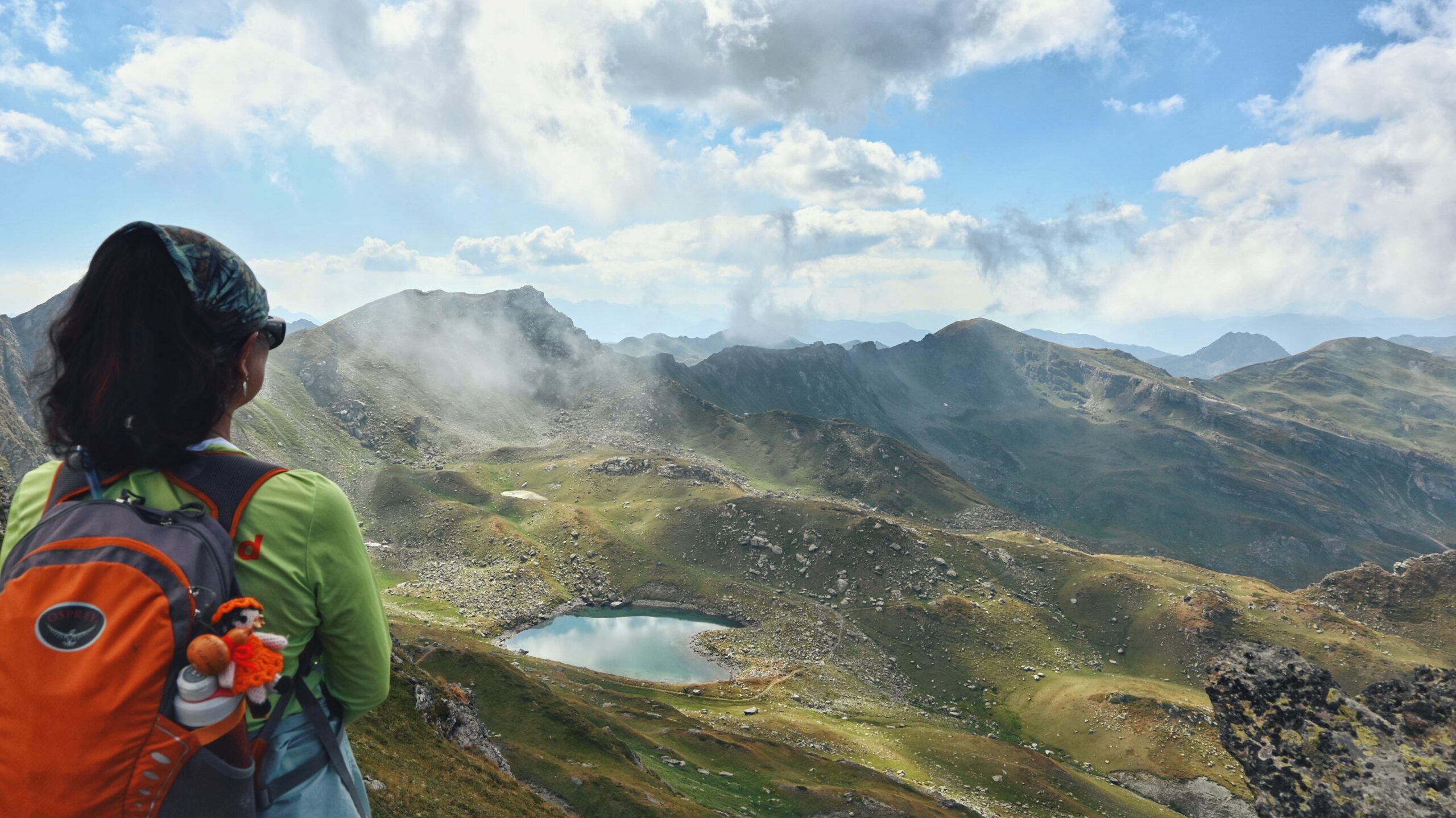
First section of the trail goes for approx. 3.5km North-East (NE) through Doberdol Valley which is one of the most beautiful valleys in whole Peask of the Balkans trail. It reminds very much the Scottish Highlands. At 2275m of altitude the trail crosses through Ali Peja Pass from Albania into Kosovo. The pass itself offers breathtaking panoramic views in all three countries. From this point and on, the trail stays in high altitude mainly in Kosovo territory as after 3.1km South-East (SE) at 2290m reaches one of the most iconic lakes which have a heart shape and blue turquoise color. From the lake the trail continues to climb for about 1.2km South-East (SE) until it reaches the ridge in 2440m.
The last section of the trail goes in a straight line with Gjeravica Peak, East (E) direction, with a slight descent in the beginning, and after a few hundred meters starts to climb directly to the Gjeravica Peak 2656m.
Gjeravica Peak is the Highest Peak of Kosovo, from where there is a 360⁰ panoramic view, from where it is possible to see endless mountain ranges within Accursed Mountains National Park. The way back to Doberdol from the Peak goes the same way, following the trail back to Ali Peja Pass, from where it continues slightly left, North-West (NW) direction, where after 1.1km the trail reaches another glacial lake called Tropoja Lake at 2250 meters of altitude.
The last section follows a 2.3 km trail with a moderate descent towards Gacaferi Guesthouse.
Video description of the trail
Trail Map
Elevation Profile
Download GPX Track
Import this track into your GPS device or hiking app