
Vusanje (Vuthaj), Montenegro – Theth, Albania
Difficulty: moderate
Vusanje (Vuthaj), Montenegro – Theth, Albania
Vusanje to Theth Hike: A Complete Guide to the Ropojane Valley Trail
The Vusanje to Theth hike is one of the most rewarding multi-day trails in the Balkans, taking hikers through remote valleys, historic border crossings, and breathtaking Albanian Alps scenery.
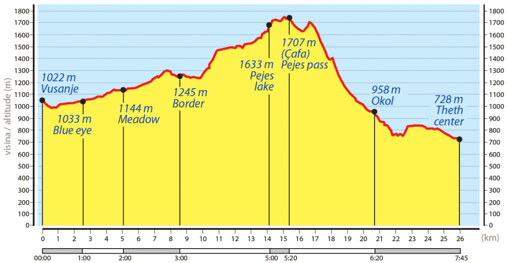
The trail starts in Vusanje village, following a scenic 4WD track west into the Ropojane Valley — a vehicle transfer option is available for those who prefer to skip the opening stretch. A forest shortcut cuts across part of the track before arriving at a historic Montenegro-Albania border crossing, where Cold War-era bunkers and pyramid boundary markers offer a fascinating glimpse into the communist past.
Crossing into Albania, the path climbs through dense beech and birch forests before opening onto the high alpine meadow of Fusha Runices. In summer, shepherd camps dot the landscape and visitors are often warmly welcomed to sample fresh sheep cheese, homemade yogurt, cold milk, and traditional raki — an authentic cultural experience you won’t find on mainstream hiking routes.
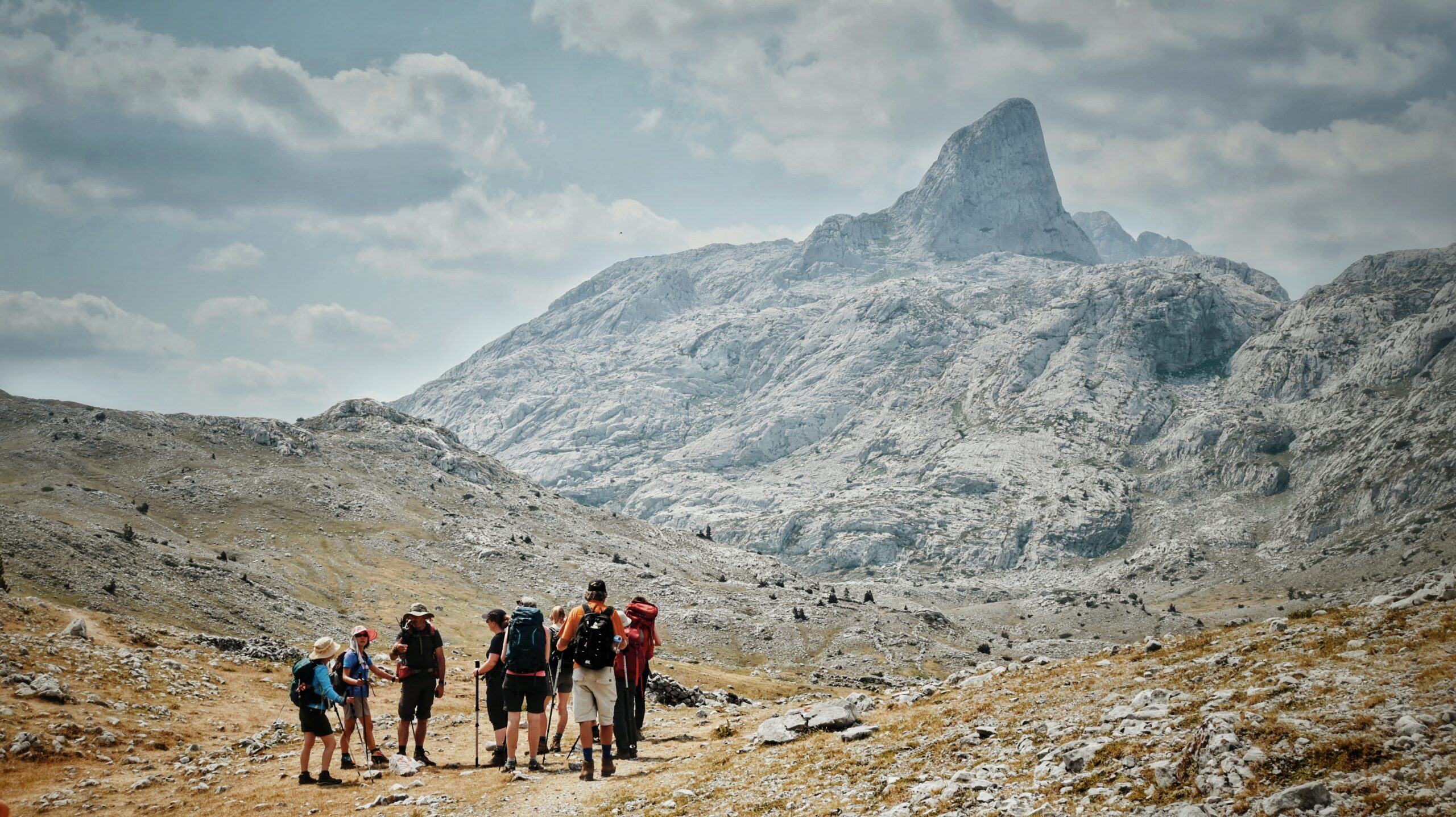
The route then winds past former Albanian military outposts, descends to the crystal-clear Lake Pejës, and ascends to Peja Pass (Qafa e Pejës). From the pass, panoramic views stretch across the iconic Theth Valley — one of the most photographed alpine landscapes in the Western Balkans. A clearly marked side trail from the pass leads to the summit of Harapi Peak, ideal for experienced hikers seeking an extra challenge.
A steep but well-managed zigzag descent through dramatic limestone cliffs and fragrant pine forests brings you down toward Theth. The trailside café “Te Kroni” is a popular rest stop for refreshments, with an optional vehicle transfer available to Shkodra for those ending their journey here.
The final section follows a peaceful rural track past traditional guesthouses and campsites into the heart of Theth — a remote mountain village celebrated for its centuries-old stone houses, waterfalls, and unspoiled alpine lifestyle. Theth is a must-visit destination on the Peaks of the Balkans trail and a highlight of any Albania hiking itinerary.
Trail Map
Elevation Profile
Download GPX Track
Import this track into your GPS device or hiking app