
What is Trailhead: Peaks of the Balkans hiking guide 2026
Many hikers planning their first trek on the Peaks of the Balkans encounter the term ‘trailhead’ and wonder what it actually means. Understanding trailheads is crucial for navigating this spectacular 192-kilometer circular trekking route that crosses Albania, Kosovo, and Montenegro. This guide clarifies what trailheads are and how they function specifically on the Peaks of the Balkans trail, helping you plan a successful adventure in 2026.
Table of Contents
- What Is A Trailhead And Why Does It Matter For Hiking
- Overview Of The Peaks Of The Balkans Trail And Its Trailheads
- How To Find And Prepare For Trailheads On The Peaks Of The Balkans Trail
- Customizing Your Peaks Of The Balkans Hiking Adventure From Different Trailheads
- Explore Your Peaks Of The Balkans Adventure With Expert Support
- Frequently Asked Questions
Key takeaways
| Details | |
| Trailhead definition | The official starting point or main access area of a hiking trail, typically marked with signage and parking facilities. |
| Peaks of the Balkans route | A 192-kilometer circular trek crossing three countries with multiple access points for flexible planning. |
| Best hiking season | June through September offers optimal weather conditions for this challenging high-elevation trek. |
| Elevation challenge | Hikers face up to 33,500 feet of cumulative elevation gain across the complete circuit. |
| Route flexibility | Multiple trailheads allow you to customize your adventure based on fitness level and time availability. |
What is a trailhead and why does it matter for hiking
A trailhead is the designated starting point or primary access location where a hiking trail officially begins. It serves as your gateway to the wilderness and typically includes practical features like parking areas, informational signage, trail maps, and sometimes restroom facilities. For adventure travelers, the trailhead is where preparation meets execution.
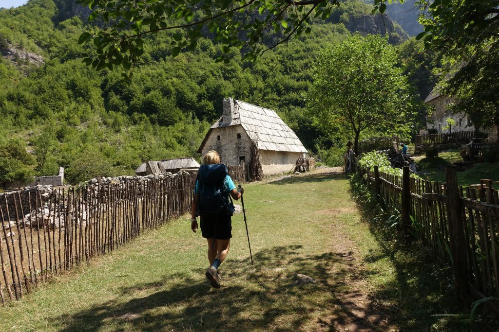
On the Peaks of the Balkans trail, understanding trailheads becomes even more critical because this international route offers multiple entry points and the signage is not so obvious. Unlike trails in Western Europe where trailheads have parking and facilities in the Peaks of the Balkans, trailheads are mostly guesthouses. However, with the development of the trail, not all guest houses can be considered on the trail.
Overview of the Peaks of the Balkans trail and its trailheads
The Peaks of the Balkans is a remarkable 192-kilometer loop that crosses the borders of Albania, Kosovo, and Montenegro multiple times. Established in 2013 as a symbol of peace and friendship among these nations, the trail showcases stunning mountain scenery, remote villages, and cultural diversity rarely found on a single trekking route.
The physical demands are substantial. Hikers can expect up to 33,500 feet of cumulative elevation gain throughout the complete circuit, making this a challenging adventure suitable for experienced trekkers. The trail’s circular nature means you can start from various trailheads and still complete the full loop.
Key starting trailheads include areas near Peje, Kosovo, Theth in Albania and Vuthaj and Plav in Montenegro. Each offers unique advantages depending on your travel logistics and preferred route direction. Some hikers begin in Montenegro, while others find Albanian starting points more convenient based on international flight connections.
| Trail Statistic | Details |
| Total distance | 192 kilometers (119 miles) |
| Countries crossed | Albania, Kosovo, Montenegro |
| Elevation gain | Up to 33,500 feet cumulative |
| Best hiking season | June to September |
| Trail type | Circular loop with multiple access points |
You will find more detailed planning information in our summary of the Peaks of the Balkans trail. Understanding the trail’s scope helps you select the trailhead that best matches your adventure timeline and fitness level. Working with POB local guides can also help you navigate trailhead logistics and cultural nuances at border crossings.
How to find and prepare for trailheads on the Peaks of the Balkans trail
Locating your starting trailhead requires advance planning and the right resources. Official trail maps and online guides provide GPS coordinates and detailed directions to each major access point. The Peaks of the Balkans trail map , while for each hike, you can find the GPS files in the stages section.
Local transport to trailheads varies by location. Shkodër offers the most accessible starting point with bus connections to Komani Lake and a transfer to Valbona, and you can use taxi services to Theth.
Preparing for the Peaks of the Balkans requires attention to elevation and weather variability. Here are five essential preparation steps:
- Study your chosen trailhead location and confirm transport options at least two weeks before departure.
- Check the location of the Guesthouse and its distance from the trailhead.
- Download offline maps and GPS tracks since mobile coverage is unreliable in remote areas.
- Arrange accommodation for your first and last nights near your chosen trailhead to buffer travel delays.
Pro Tip: Register with local guides or inform accommodation providers about your planned route before starting from any trailhead. This simple step creates a safety net if you encounter problems on the trail and ensures someone knows your expected timeline.
Our self-guided Peaks of the Balkans tours include detailed trailhead information and pre-arranged logistics that eliminate guesswork from your preparation process.
Customizing your Peaks of the Balkans hiking adventure from different trailheads
The Peaks of the Balkans offers a ‘choose-your-own-adventure’ experience, allowing hikers to customize their route based on available time, fitness level, and personal interests. Your choice of starting trailhead significantly influences the character of your trek and the cultural experiences you encounter first.
Different trailheads offer distinct advantages:
- Shkodër provides easy access with good infrastructure but, but you need half a day to a full day to get to the trailhead in Theth or Valbone.
- Peja is closer, and with a taxi, you get to the trailhead in 30 minutes, in Drelaj or Reka e Allages.
- Vusanje/Vuthaj and Plav offer direct access to the trail, but getting thereis far from any regional airports.
| Starting Trailhead | Primary Advantage | Typical First Day | Transport Complexity |
| Shkodër area | Accessibility and infrastructure | Bus and hike if you choose Theth through Nderlyse | Easy (bus and taxi available) |
| Theth | Immediate mountain immersion | High altitude start | No transport needed from Theth |
| Vuthaj | Optimal clockwise route positioning | Gradual ascent with valley views | Moderate long ride from POdgorica airport. |
Customizing your route involves balancing several factors. Distance considerations affect how many days you need and which sections to prioritize if time is limited. Elevation preferences help you decide whether to start high and descend or build endurance with gradual climbs. Border crossing logistics matter because some routes involve more frequent crossings requiring additional passport checks.
Accommodation availability varies along different sections. In some villages the accommodation is abundant, while is some others there is not enough. Make sure you book on time as, just appearing at a guest house without booking may leave you outdoors or getting the worst available option.
Pro Tip: Flexibility in route planning enhances your adventure experience by letting you adjust for weather changes, unexpected trail conditions, or simply spending extra time in places you love. Build buffer days into your itinerary rather than committing to a rigid schedule.
Explore our sample Peaks of the Balkans itineraries to see how different trailhead choices create unique adventure experiences. Our 10-day self-guided Peaks of the Balkans tour provides a balanced route suitable for most fit hikers with limited time.
Explore your Peaks of the Balkans adventure with expert support
Now that you understand trailheads and route options, you are ready to transform knowledge into action. Planning a multi-country trek involves many moving pieces, and having expert support makes the difference between a stressful experience and an unforgettable adventure.
Our platform offers both guided and self-guided hiking tours designed specifically for the Peaks of the Balkans. We provide comprehensive planning resources, detailed maps, and connections to experienced Peaks of the Balkans local guides who know every trailhead and route variation intimately.
Whether you prefer independent trekking with backup support or fully guided experiences with logistics handled for you, our complete Peaks of the Balkans guide covers everything from visa requirements to cultural etiquette. Visit Peaks of the Balkans hiking tours to explore your options and start planning your 2026 adventure today.
Frequently asked questions
What exactly is a trailhead in hiking terms?
A trailhead is the official starting point or main access area of a hiking trail. It typically includes parking facilities, informational signage, trail maps, and sometimes restrooms or ranger stations to help hikers prepare for their journey.
When is the best time to start hiking the Peaks of the Balkans trail?
June through September offers the best conditions for hiking this trail. Starting during this window ensures mountain passes are snow-free, weather is more predictable, and village accommodations are fully operational throughout the route.
How do border crossings work when hiking between countries?
You will cross international borders multiple times on the Peaks of the Balkans. Carry your passport at all times and expect informal checkpoints at border areas. Most crossings are straightforward for hikers, but customs officials may ask about your route and destination.
Can beginners hike the Peaks of the Balkans trail?
This trail suits experienced hikers with good fitness levels due to significant elevation gain and remote sections. Beginners should consider shorter sections rather than the full circuit, or join guided tours that provide additional support and safety measures.
Where can I find accommodation along the trail?
Most villages along the route offer guesthouses with basic amenities and home-cooked meals. Some remote sections require camping or staying in mountain huts. Advance booking is recommended during peak season from July to August.
How do I choose which trailhead to start from?
Consider your arrival logistics, preferred route direction, and fitness level when selecting a trailhead. Shkodër offers easiest access for most international travelers, while Theth provides immediate mountain immersion. Review detailed itineraries to match trailheads with your adventure goals.