
Reka e Allages, Kosovo – Pepaj, Kosovo – Drelaj
Difficulty: moderate
Reka e Allagёs – Pepaj – Drelaj
Few stages along the Peaks of the Balkans manage to pack in as much variety as this one — a steady forest climb, a high alpine pass, the option to bag one of the route’s finest summits, and a long descent into Rugova Valley. It’s a full day out in the mountains, and one of the more memorable stretches of the entire trail.
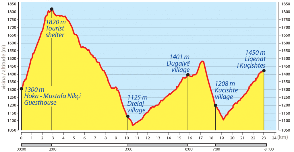
The stage starts at Reka e Allagës (1,300 m), setting off northwest behind Guesthouse Ariu through open meadows before the trail picks up a 4WD track and heads into dense pine forest. The climb to Qafa e Gjonit — Gjoni’s Pass at 1,810 m — covers 3.2 km at a steady gradient. At the top, the trees give way to open alpine pasture and a small wooden shelter where you can catch your breath and take in the ridgeline views stretching in every direction.
From the pass it’s another 1.2 km to “Stani i Fatosit”, a seasonal mountain cabin that serves as a welcome refreshment stop when it’s open. It’s also the jumping-off point for the ascent of Hajla Peak (2,403 m) — the highest summit on the north side of Rugova Valley and arguably the best viewpoint on this section of the trail.
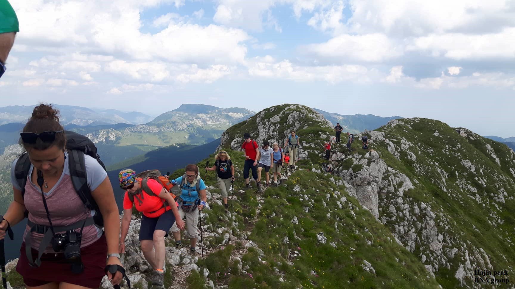
The climb to Hajla gains 600 metres over 2.5 km. It’s a serious undertaking suited to experienced hikers, but the reward at the top is hard to argue with: the Kosovo–Montenegro border ridge running underfoot, and an unobstructed 360-degree panorama stretching across two countries. On a clear day it’s genuinely one of the most dramatic vantage points on the whole Peaks of the Balkans circuit.
After descending from Hajla, the trail reconnects with the main Peaks of the Balkans route near Pepaj — a small, partly seasonal shepherd settlement with a scattering of modern chalets. The path then winds downhill through forest and open terrain for the final 3.1 km into Drelaj.
Drelaj is one of the few villages in Rugova Valley that stays populated year-round, and it has a distinct character to match — a small early 20th-century mosque, a tradition of local dairy production, and several guesthouses that offer a genuinely warm welcome after a long day on the trail. If you have a spare day, the historic city of Peja lies just 18 km away by car, with Ottoman-era bazaars, monasteries, and local food well worth the short detour.
Trail Map
Elevation Profile
Download GPX Track
Import this track into your GPS device or hiking app