
Milisevc, Kosovo – Reka e Allages, Kosovo
Difficulty: moderate
The first hike inside Kosovo
The Milishevc to Reka e Allagës stage is a visually diverse and physically rewarding section of the Peaks of the Balkans trail, featuring dramatic elevation changes, sweeping alpine landscapes, and a memorable descent into the stunning Rugova Valley — one of Kosovo’s most celebrated natural treasures.
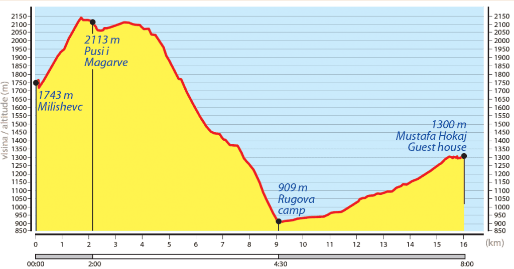
The stage departs from Zllonopoje or Milishevc, climbing gently to Lumbardhi Pass (2,100 m+), where the trail opens onto the vast Lumbardhi Plateau (2,070 m). This high alpine terrain is dotted with juniper and dwarf pine, offering wide open skies and uninterrupted mountain views that define the best of Kosovo highland hiking. The route passes near Lumbardhi Lake — a remote glacial lake traditionally used by shepherds to water their cattle — before beginning a long and scenic descent northward into the valley below.
The descent winds through a rich tapestry of conifer, birch, and beech forests, with the trail gradually softening as it drops in altitude. The forest sections provide welcome shade and a sense of true wilderness before the valley opens up ahead. The route eventually arrives at Camp Rugova, a well-known rest point in the valley where hikers can recharge with refreshments and soak in the surroundings.
Choosing a transport to cross an asphalt road
From Camp Rugova, the final 6.5 km follow the valley road to Reka e Allagës — with an optional car transfer available for those who prefer to skip the road section and save energy for the stages ahead.
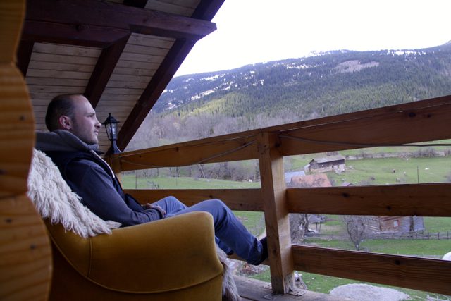
Reka e Allagës (1,290 m) is a charming seasonal shepherd village and a favourite overnight stop on the Peaks of the Balkans. With several welcoming guesthouses offering traditional Kosovar mountain hospitality, it provides a peaceful and comfortable base before continuing the trail. Located just 20 km from the historic city of Peja, it also makes an easy launching point for a cultural day trip to one of Kosovo’s most visited destinations.
Trail Map
Elevation Profile
Download GPX Track
Import this track into your GPS device or hiking app